Frequently Asked Questions
About SoilOptix®
Browse through our list of FAQ’s to learn everything you need to know about SoilOptix®. Have some hard-hitting questions not including in the list below? Bring it on! Contact us directly, we’d love to chat.
What is the SoilOptix® sensor measuring?
The SoilOptix® sensor is measuring gamma radiation, a form of penetrating radiation emitted through the natural decay of radiation sources. For SoilOptix®, this source is the soil. Soil is in a constant state of decay and is always emitting gamma rays. Specifically, the sensor is reading these rays and there corresponding isotopes; the primary isotopes we focus on are Thorium -232, Uranium -238, Potassium -40, and Caesium -138 due to their stability.
Do I still need to take soil samples?
Soil samples are necessary for the completion of your SoilOptix® maps. Soil samples are taken at specific, strategic locations in the field, after completing the sensor survey. These locations are based off the radiation measured from the sensor. One soil sample must be taken for every 8 acres (3.2 hectares) surveyed. A minimum of 4 samples are needed per field. Sample depth should be between 6-8” (15-20 cm). At each sample location, the vehicle and sensor must sit and run continuously for 90 seconds. This is to calibrate the sensor readings to the field.
How often does a field need to be surveyed by the SoilOptix® sensor?
The raw radiation data can be used for up to 8-10 years after the field has been surveyed. This is because the radiation that the sensor is capturing is extremely stable and repeatable. After the initial scan, the original sensor data can be used to “resample” in the following years.
For example, most growers follow a 2- or 3-year sampling program- typically following crop rotations. On year 2 or 3, providers can go back into the field and pull new samples from the original locations. SoilOptix® will then process these results with the original sensor survey data and provide growers with updates soil maps. Growers can benefit from multiple years’ worth of updated soil maps from just one SoilOptix® scan.
How fast can I drive?
The technology of the sensor allows for units to travel through the field at speeds up to 12 mph (20 km/h). At these speeds, data is collected every 3-5 feet (1-1.5 meters) on the raw survey data.
How dense is the final data?
The final map deliverables are sent back at a resolution of 335 data points per acre (827 data points per hectare). The maps are available in Shapefile, CSV, PDF formats as well as through the SoilOptix® API.
Are there any sensor calibrations to be done from field to field?
No, the sensor is pre-calibrated upon manufacturing and is completely field ready when it is delivered to you. Therefore, there is no field-to-field calibration required.
What is the suggested swath width?
We recommend surveying the fields at 40-50 foot (12-15 meter) swath widths. For smaller fields, smaller swath widths are recommended to allow for higher definition soil maps.
What data layers can SoilOptix® provide?
SoilOptix® provides over 25 different data layers, based on the soil sample lab results. This includes macro and micro nutrients, base saturations, textures, and complex models (eg. Bulk density, plant available water, etc.)
Furthermore, we are always researching and testing new layers to offer. If there are other layers you would like to see modelled, please contact us and we can investigate the possibility. View full list of layers here
How does soil moisture and ground cover affect readings?
The SoilOptix® system is very flexible and has few limitations. One limitation we do have is rainfall. Surveying should not be done in the rain due to radon interference and should not be done in standing water, due to signal attenuation. However, soil moisture up until the point of saturation has little to no effect on the survey results. This capability also allows for surveying to be completed in up to 4” (10 cm) of light snow. Additionally, ground cover such as field vegetation or crop residue does not affect the sensor readings. This is because the sensor is specifically measuring radiation caused by the decay in soil, and is blind to all plant matter. Because of these factors, there is a much larger window of opportunity to get into the field and extends your soil sampling season.
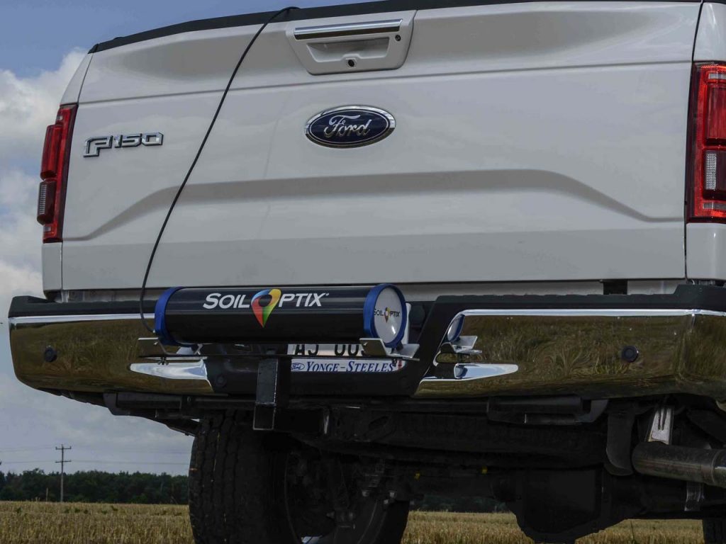
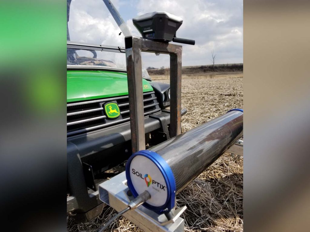
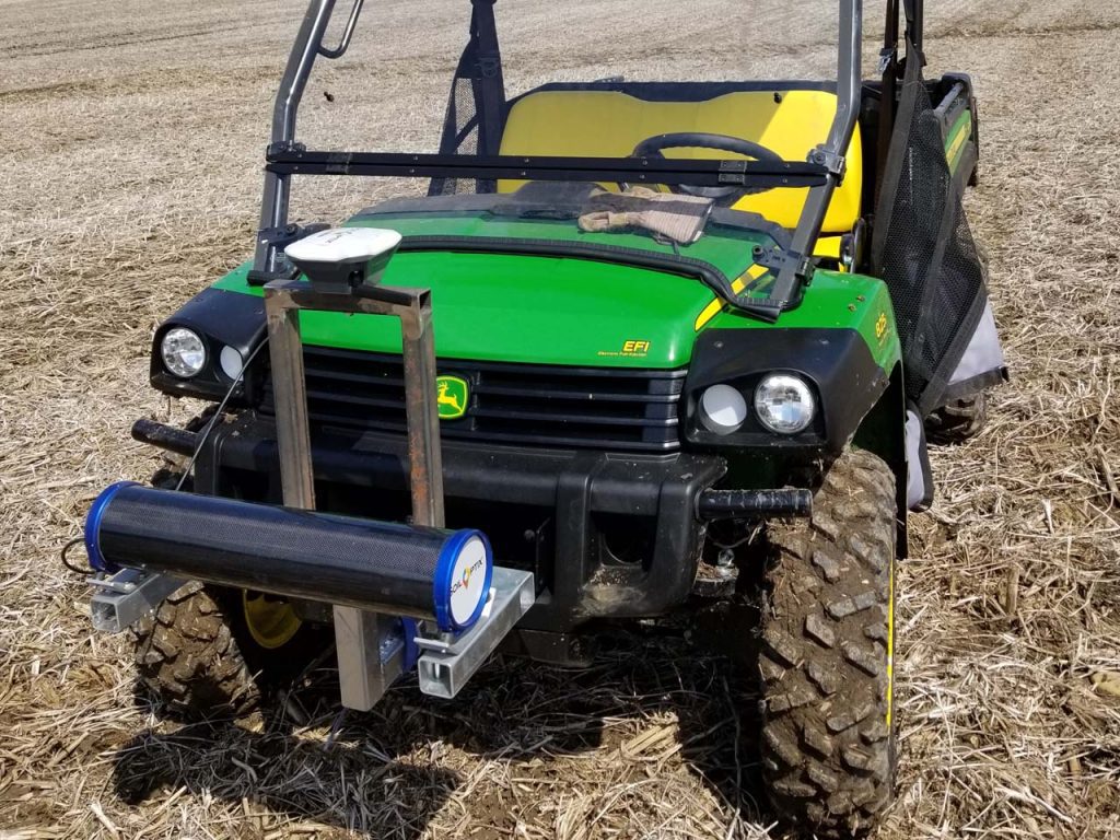
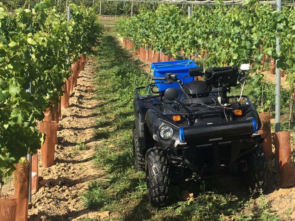
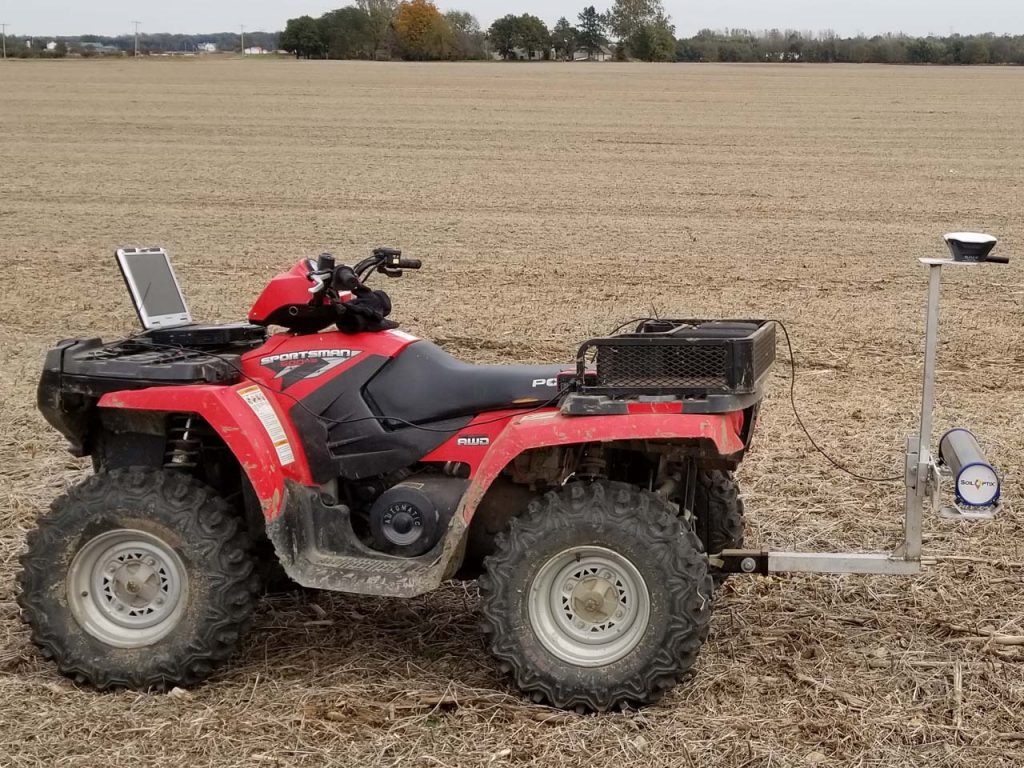
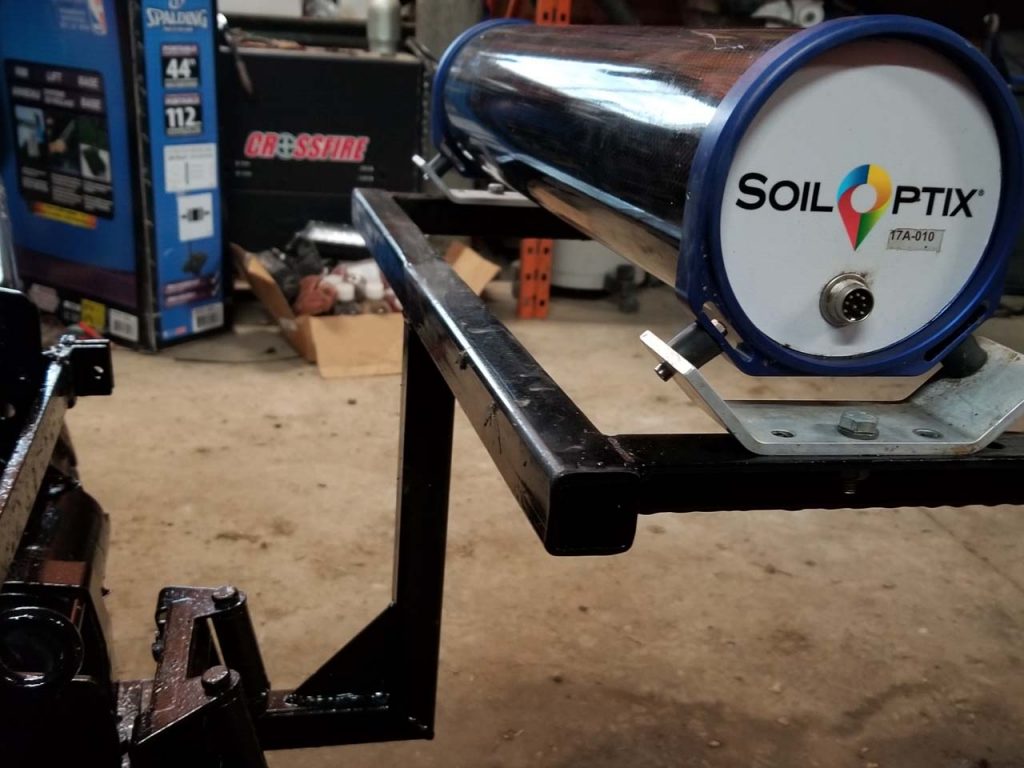
What can I mount the SoilOptix® sensor on?
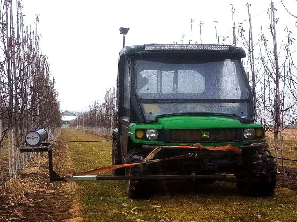
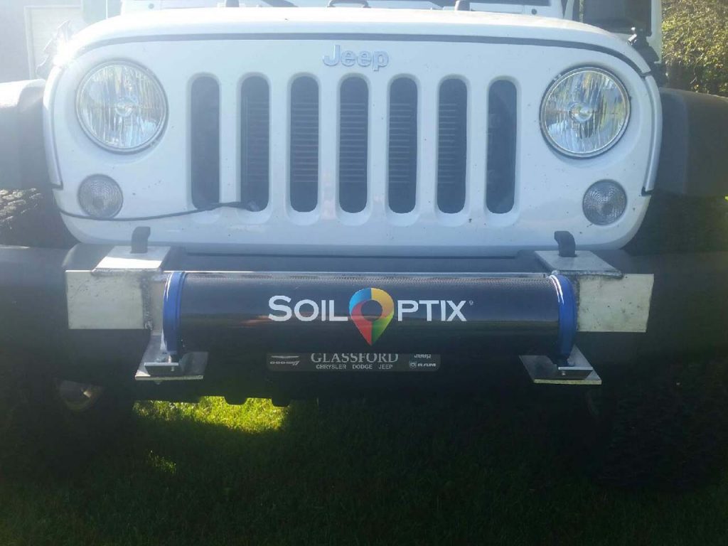
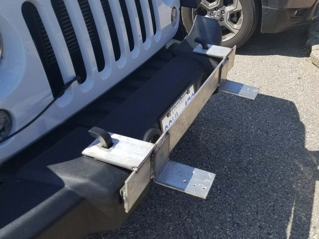
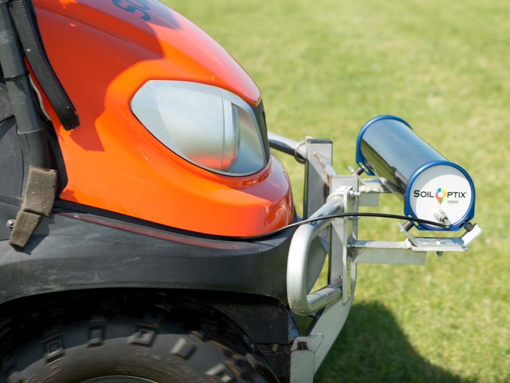
The sensor can be mounted on any vehicle that can travel across difficult landscapes (e.g. Jeeps, trucks, or side-by-side RTVs). The sensor must be mounted 2 ft (0.6 m) above the ground. Typically, customers use a standard 2 inch (5 cm) hitch receiver to attach the sensor mount to the vehicle. Vehicles also must be able to travel at consistent field speeds of 12 mph (20 km/h).
Examples of mounting systems can be seen below. Schematics are available upon request, contact us for more information.
Please note- interference below the sensor from the metal bracket should be avoided as this can block or mask the radiation being measured from the ground below.
Where do I access my SoilOptix® results?
You can access your SoilOptix results through our Customer Portal. Login credentials are provided by SoilOptix®. Contact us for more info.
Are there any radiation, health, or safety risks when using the SoilOptix® sensor?
No, our sensor is completely passive and safe. There is no harmful radiation being emitted or collected. The radiation that we are measuring is being emitted naturally, all around us every day and has no harmful effects. The sensor is simply taking a snapshot of these radiation waves and digitizing it so that we can measure it. So, no HAZMAT suits required, and you will NOT turn into the Hulk.