Soil is the vehicle that sustains human activity and the growth of animals and plants. It is the living skin of the earth. The accurate understanding and rational interpretation of soil properties and spatial distribution patterns are crucial for the sustainable development of soil resources. It is imperative to perform precise mapping of soil properties in the fields, including precision agriculture, environment protection, and land use planning.
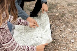
Traditional soil mapping is done by experienced soil surveyors without the help of any software. They know the area well, spend a lot of time in the field, and take soil samples at regular intervals. In this way, they create a soil map that is later printed. However, recent technological advancements in soil mapping have brought alternative means to map the soil without requiring as much manual labor. That is where soil mapping software are used.

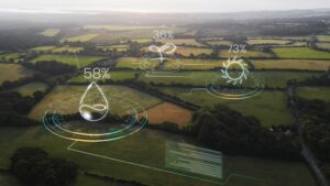
Digital soil mapping deduces soil properties at different points using digital elevation models, remote sensing imagery, and geostatistics. Digital soil mapping reflects the characteristics and patterns of soil formation and development process with spatial analysis and mathematical methods to predict the soil properties and mapping methods. In most cases, the soil sample points are obtained using field collection. This is the primary source of information on the spatial autocorrelation of soil properties and the knowledge about the relationship between environmental variables and the soil.
Whether conventional soil mapping or Clearly, the method that costs less per hectare and produces more accurate maps is a better option.
Modern soil mapping includes both traditional and digital soil mapping techniques. With the growing trend in digital soil maps/mapping (DSM), there has been a downward trend in conventional maps/mapping. Traditional soil mapping techniques are not as outdated as they are sometimes made out to be. But in most cases, the quality and the amount of data attained through digital soil mapping software are much more advanced than the traditional techniques. This is where digital soil mapping truly shines because it will be impossible to use all the data for mapping soil through traditional methods.
A Comparison of Efficiency among Digital & Traditional Soil Mapping Spatial Data Models
Let us start with the spatial data models (used to conduct geospatial analysis for better decision-making in crop production). The polygon data model is mainly used for traditional soil mapping. The polygon data model (lines, points, and polygon shapes) is used on paper maps because those shapes can be easily drawn by hand. On the contrary, the raster data model is popularly used for digital soil maps because it is a highly efficient way to store and analyze spatial information in a digital format. It is a regularly spaced grid of cells. Thus, the amount of geometric information required can be minimized.
In digital soil mapping, the raster data models are more appropriate because they represent continuous fields, and soil landscape is a continuous field. Also, it is important to remember that there are examples of discontinuous breaks in the soil. However, assuming the soil landscape being mapped as continuous, the raster data models are better because they can store data more efficiently than polygons. For instance, when you draw a circle with 100 vertices, it will look more like a circle than the one drawn with 10 vertices.

Now, the question is, what about the polygon data model? Does it represent continuous fields? Yes, the polygon data model can represent continuous fields, but there are limitations in how much information can be communicated with contours or isolines.
Base Maps
The most obvious difference between traditional soil mapping and soil mapping software is the availability of better base maps through digital soil mapping. Better base maps are available and combined with higher efficiency and consistency. The data can be processed in the Geographic Information System. Digital soil mapping produces much more accurate base maps. With digital methods, it becomes easy to quickly analyze the base map data and apply the quantitative determinations, making them the most consistent across the map area. The limitation in the base maps is a crucial factor to consider while evaluating the traditional soil maps. It becomes extremely time-consuming to delineate the small areas. Also, predicting the variation in soil landscape becomes difficult.
Efficiency in Estimating the Potential Error
Digital soil mapping uses Gaussian statistics to estimate the potential error to predict the variations. This certainly has its benefits. However, it is not fair to say that traditional soil mapping doesn’t offer a scope to predict the variations. If you compare the soil property ranges within a conventional soil map’s attribute table with digital mapping, the prediction intervals are based on better statistical methods for digital topsoil mappers. In today’s digital mapping software, it is easy to manage a lot more data efficiently, and that is a significant benefit.
In Conclusion
Digital soil mapping methods have advanced and empowered the ability to map soil. The best factors of digital soil mapping are higher consistency and better efficiency in synthesizing data. With the speed with which digital methods analyze data, it has become easier to leverage significant data (using remote sensing) and use the data in multiple ways. As we move forward with digital soil mapping, it is crucial to recognize the reasons for choosing digital methods instead of sticking to the traditional ones. If you are searching for the best support in soil mapping and measuring soil fertility, contact SoilOptix® today! Visit https://soiloptix.com/ for details.
