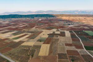
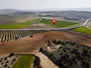
The evolution of technology has initiated a revolution in how food is produced. Innovations in remote sensing, artificial intelligence, and imagery have improved the mapping capabilities of agricultural areas. This is referred to as field mapping. With the rapid changes in environmental conditions, tools like field mapping will be crucial to food security in the coming decades.
Emergence and Functions of Field Mapping in the Modern Agriculture
Recent technological innovations have changed the way modern agriculture is conducted. From agriculture to real-time data analysis, innovations have led to better management and monitoring practices. Therefore, it leads to higher yield and better-quality crop production. Additionally, technological advancements have allowed higher precision in fertilization and soil management. This leads to better sustainability and higher environmental protection.
In the wide array of recent transformations, field mapping is a practice that holds high potential. Archaeological findings have indicated that farmers were specifically adept at field mapping because it was used to organize and protect the areas for cultivation throughout medieval Europe.
For modern agriculture, field mapping is closely associated with precision agriculture. It is becoming an increasingly crucial tool for crop production and land management. Field mapping ensures precise and accurate data collection about the field’s physical features and helps the farmers to maximize their yields. With this technology, the farmers can identify the soil types and track the changes over time to better understand the management strategies and determine the problem areas for improvement.
The present applications for field mapping include the use of wireless sensors and metrics to environmental indicators to monitor crop health more effectively. Even though field mapping remains a cornerstone of modern agriculture, there are specific challenges for the stakeholders.
Field Mapping Agriculture Practices with Geographic Information System (GIS)
The future of agriculture will prioritize sustainability in land management practices. It will help to increase productivity and reduce waste. More importantly, this is how modern technology like sensors and geographic information systems will be available to the farmers. The future is already being realized because more and more people have the ability to implement field mapping agriculture techniques in their operations.
Since farming is a location-based activity, GIS is especially helpful in fine-tuning the planting, harvesting, and irrigation procedures. To ensure sustainability in agriculture, it is crucial to preserve and conserve natural resources. This is only possible if the farmers have a clear understanding of the resources. GIS is the best and most cost-effective way to accomplish this. Indeed, understanding the natural inputs of the environment doesn’t mean that one can control them. It only means that the farmers can make better and more informed decisions moving forward.
Field Mapping in Agriculture
Agricultural field mapping is a meaningful way to monitor your land and manage future activities. It helps to understand and map different information that includes data regarding soil health and nutrition, water and irrigation systems, and slopes. When done accurately, it empowers you to employ different land management practices designed to use the land optimally, enhance productivity, use resources more efficiently, and reduce potentially damaging activities.

GIS in Precision Agriculture
Precision agriculture is a type of land management that focuses on tailoring activities to meet the needs of a specific part of the land. It involves observations and measurements of variables about different fields like the type of soil, the capabilities of each type of soil, water movement, sloping and even how much sun every area receives.
If you have uniform fields, precision agriculture will be unnecessary, but this is typically not the situation. Variations in slope will affect the rainfall, and it will affect the fertilizer. The fertilizer might get washed away from certain areas due to uneven rain and be collected elsewhere. Thus, it will result in overwatering and over-fertilization in certain areas and negatively impact crop yield. Field mapping agricultural lands allows the farmers to deploy the resources more sparingly while improving the harvests.
The geospatial tools are the best places to start this process. GIS, once only a tool allotted the professionals with the right expertise, is now widely available and can offer anyone soil surveys, satellite imagery, topography, infrared data, information on water, and more. Within a few minutes, the farmers will understand the contours of a field, the areas where water is likely to get collected due to heavy rains, which sections of the land get the maximum sunlight, and where you should plant specific crops for the best results.
GIS in Contour Farming
Contour farming is practiced for centuries, but the advent of new technology makes it much more effective and easier to implement than ever. The concept is quite simple. Instead of planting crops manually in uniform, straight rows, you can perform these operations throughout the contours of a slope.
Plowing and planting along the contours will do a lot of good things to the field. It helps in keeping the topsoil from eroding and prevents the removal of nutrients. It increases water infiltration, giving rainfall and fertilizers the necessary time to soak into the soil rather than running off. Therefore, it increases water storage on the slope. The farming operations can be enhanced by adding other practices like strip cropping (alternating the rows between different crops will prevent soil erosion), digging the ditches will divert the rainwater, and mulching specific areas will protect the soil.
Contour farming needs some preparation to get started. First, you must perform a topographic survey of the field. You can do this with a GIS tool, and if it’s mobile capable, you can even take your maps into the field. You must determine the length of the slopes, the ridge height, and the minimum & maximum row grade. You should also remove any potential obstructions and ensure enough room for the farm equipment to operate and turn around.
Field Mapping Agriculture Practices with GIS
Farming is not far from the land of modern tech and gadgets, especially when the agricultural sector is embracing the benefits of utilizing GIS. The truth is the farmlands are pushed to the limits to meet the global demands. Without taking advantage of the tools that can help the farmers to increase output and manage the inputs, agricultural activities will not be sustainable.

There is no denying that the ability to understand every aspect of your land and map it out effectively is invaluable to maximizing productivity and ensuring the continued health of every section of the land. Field mapping enables us to visually analyze all the resources, retrieve soil reports, learn the activities soil can tolerate, map out water features and FEMA floodplains, and view topography and contour lines.
Field Mapping as a Path to Success in Precision Agriculture
Global Positioning Systems (GPS) and Global Information System have advanced rapidly in the last few years. These advancements, combined with real-time data collection and accurate positive information, enables efficient analysis and manipulation of the geospatial data. The best part is that such technology is compatible with many mobile phones with GPS chips.
Precision maps are an essential tool in precision agriculture. They help growers by showing them the exact locations on the farm and offer them specific information regarding the location. One of the most essential features of a precision map is that it includes geo-referenced data that is used to show information regarding a precise location in a piece of a farm as well as information or characteristic of a soil or a crop, like the moisture levels, crop yield soil nutrient levels and many more.
Global Positioning System is used to achieve precision farming that facilitates field mapping, farm planning, soil sampling, yield mapping, and crop scouting. Further, GPS allows growers to work well under low-visibility field conditions like fog, dust, rain, and darkness.
It is essential in correlating crop yields and production techniques with land variability. This correlation enables the growers to come up with the most suitable soil treatment strategies, increasing farm production. The maps generated can be used for the precise application of water, fertilizers, herbicides, and pesticides. Application and dispersion of such chemicals ensure environmental sustainability and reduce expenses or input costs while optimizing the yields.
Precision agriculture mapping includes a timely collection of geospatial data about the plant or soil properties and requirements and later applying and prescribing site-specific treatments to increase products while ensuring the environment is protected at the same time. This is micromanaging of firms. Field mapping is one of the most important tools in precision farming because it facilitates the use of technical tools in the agricultural industry that are more precise, user-friendly, and cost-effective. Most agricultural tools require you to being in sync and well-interpreted with data collection sensors, computers, GPS, and time reference systems.
Small business owners can also reap the benefits of precision agriculture. Unmanned aerial vehicles (UAV) like drones can be acquired cheaply and are user-friendly. In fact, they can be flown easily. Information and feature acquired through mapping can be used for improving land and water. This is done by determining the economic threshold for handling pests, weeds, soil enhancements and protecting the natural habitat for the future.
The good news is manufacturers have developed different tools for growers and agribusinesses to become efficient and more productive in precision farming activities. In modern agriculture, farmers use global positioning system-derived products to increase productivity and enhance their operations in agribusiness.
How Field Mapping Works?
Precision maps work with a wide array of other physical sensors and global positioning system information to analyze different characteristics known as variables like soil and crop moisture, crop yield, and more. The information is crucial to locate different points of requirements. Therefore, this information saves time and money for the farmers preventing the application of fertilizer, pesticides, or water, among other farm inputs.
Usually, the information on the location is collected by the global positioning system receivers that map the field boundaries, irrigation systems, and problem areas in the field or the crops like weeds, insufficient moisture, pests, or diseases. The accuracy of GPS enables the farmers to create field maps with precision per acreage for field areas, road locations, and distances between any points of interest. GPS helps the farmers to navigate to a specific point in a field, collecting data at the same time every year.
There are different types of precision maps. These maps enable users to see things spatial variabilities across the entire field area at a very high resolution, giving them the ability to make informed decisions that are accurate. Types of precision mapping include:
Soil Maps –
These are geo-referenced maps collected in different ways, like dividing the field into a grid block or taking samples of field zones generated by yield maps or topography maps.
Yield Maps –
The yield map primarily focuses on the crop yield, for instance, how productivity exists in one area of the field compared to the other.
Field mapping directly benefits from improved Unmanned Aircraft Technology that has become popular in recent years. Cheap and reliable UAVs combining hyperspectral, multispectral, near-infra-red, and multi-layering imagery can be obtained and used with little or no training, depending on your region’s regulations. The data is processed to inform key management ranging from crop water intake to pesticide usage, risk of crop losses, and many other critical elements.
The combination of technologies also offers promising opportunities for improving the accuracy, effectiveness, and precision of field mapping tools. From web-based data storage to machine learning algorithms integrated into UAVs and mobile apps, field mapping has become increasingly automated while maintaining effectiveness. If you are searching for the best support in field mapping, get in touch with SoilOptix® today! Visit https://soiloptix.com/ for details.
