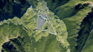
Today, the world is experiencing a new agricultural revolution that came with the development of precision farming. Agriculture is one of the most important contributors to the economy, and we need it to stay that way. Therefore, it is crucial to understand what is happening in the field and how it affects the world. For quite a long time, the agriculture industry has been using maps to manage and grow crops. Field maps are used to plan where the farmers will plant their crops, how much of each crop they must plant, and estimate how much money they can make from every crop. When using various farming maps, it is crucial to understand how to read it and what information it offers.
Field mapping will show different types of soil types, their fertility, and the different types of vegetation in the area. This information can help the farmers determine where the fields are located and what type of crops they should plant there, depending on the fertility levels and soil types. A useful field map must be easy to read and understand. It must be detailed, accurate, and up-to-date.
Why Do We Need Field Mapping in Agriculture?
Field mapping also allows you to check how the farm compares with other farms in your area and offers an idea of what crops will grow well. Using an agriculture map will help you plan crop rotations and determine which crops will offer the most money for every acre of land you have available.
Field mapping is the process to use GPS and other technologies for mapping out the land. It is used by farmers and agribusinesses to gather information about the crops and fields, like how fertile they are or how much they have grown. Field mapping uses real-time GPS to make sure that you get accurate geo-spatial information about the land. This is very different from traditional surveying methods because it doesn’t require a surveyor or equipment.

How to Prepare a Useful Agricultural Map?
Here are some tips to create a usable agricultural map:
Using aerial photographs for the base layer. This will offer a visual reference for other layers and allow better accuracy with field boundaries.
Use clear labeling on the buildings, roads, and other features that require identification. It is crucial to make sure that every label is located directly above the corresponding feature, so it is easy for the users to find where they are located on the map.
The text must be large enough so that it can be read easily from a distance away from the screen. This will help avoid any confusion or misreading when someone is trying to interpret what they are looking at while working on the field or making decisions about land management practices.
Adding in other various data layers like soil information, yield data, weather information, and satellite imagery can add additional value and levels of insight into your farming operation, to base management decisions off of.
How does Satellite Imagery help Farmers?
Satellites and the associated technologies are not only helping farmers manage their farms effectively, but they are also changing the way global farming is done. Satellites offer farmers with the vision and insight of the complete farmlands from viewpoints that they could never dream of a few decades ago.
The different ways that satellites help farmers in managing the farms effectively are as follows:
Field Mapping – This is the initial step in precision agriculture, which includes using satellites for a thorough mapping of the complete land. This is specifically beneficial for the large farmlands that enable the farmers to identify and prioritize the land, depending on the spatial characters.
Measuring & Studying – There are multi-spectral cameras and sensors that are fitted to the satellites directly or indirectly to offer a measurement of the vast array of important farmlands like nutrition, crop health, soil water stress, plantation stage, diseases, and weather patterns.
Execution and Monitoring- Satellite data and their functions are crucial to run automated technologies and allow varying irrigation patterns and the varying rates of fertilizer application accurately. Apart from that, as the images pile up one after another, they reflect the pattern of the farmland characteristics as well as the environment. This helps in predicting the future events and plan and prepare in advance to have the highest chances of reducing the extreme loss events from climate changes, droughts, diseases outbreaks and more.
Field mapping is crucial for optimal agricultural growth. For the best field mapping and analysis, contact SoilOptix® today! Visit https://soiloptix.com for details.
