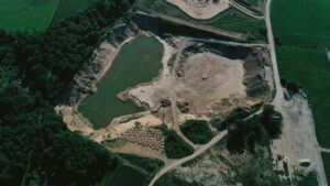
Soil is one of the most crucial aspects of any agricultural production system. Different soil components can significantly affect crop or pasture yield and quality and play increasingly crucial roles in environmental sustainability. Farmers have been adapting their management strategies for centuries based on the observed physical and visual properties of soils, with very recent technological advances assisting in this practice.
Soil survey and mapping is a technique that has become common in precision farming. It uses the most advanced technology to obtain the most accurate information about the soil conditions, weather, and crops.

Source: Freepik
How Do We Carry Out a Soil Mapping?
We have several techniques available to make maps that give us different layers of information about the soil. Works were traditionally created with open soil pits, but we can now resort to much more advanced tools. The main ones are these:
-
Proximal sensors:
These involve utilizing sensors that are in close proximity to the area of sensing, such as ground based sensors like SoilOptix®’s gamma radiation spectrometer, a vehicle-mounted sensor that measures the natural geological signature of the soil, providing accurate high-resolution datasets.
-
Remote sensors:
In this case, utilizing resources like satellites and unmanned aerial vehicles (UAVs), like drones, can help collect data efficiently and at a large scale.
-
Traditional soil sampling:
Maps can be made using traditional soil sampling data such as that collected with grid sampling, by averaging out the values from the points of collection and creating a map. These are cost-effective, but low resolution and can miss key information necessary for managing fields accurately.
What is Web Soil Survey?
Web Soil Survey is the largest public-facing natural resource database in the world. Whether you manage 10,000 acres or measure your land in square feet, you can use WSS to learn more about your soils through customizable maps, properties, and interpretations – all free and downloadable. People can visit the Web Soil Survey website to access the data and create their soil survey for their chosen areas.
How Are Soil Maps Made?
The USDA creates soil maps through various means. They go to the region where they map and compile data through the method of physical field sampling and technology. They also collect additional data through aerial photography and other types of sensing technology.
Technology has transformed how the USDA maps the various regions where it gathers data. In the past, researchers had to input their data using paper maps, cameras with developed film, and topographic sheets.
Now, they can use tablets that offer GPS and all the map equipment they need. Their digital photos and other crucial data can all be combined using the tablet to create the soil map as they go along. An additional technological benefit is that these surveys had to be printed in the past. It could take years for the public to have access, leaving the potential only to access outdated information. That’s no longer true with tablets, computers, and online publishing.
Digital Soil Mapping- the New Dimension
The future for soil mapping globally seems to be in the development of digital soil mapping or DSM. It uses collected observations and data on various local soil populations across different timelines and integrates these with numerical models to infer the soil conditions and properties across more significant global regions. DSM has driven the field of soil mapping from more minor to larger areas, from simple to more complex landscapes, has moved away from 2D spatial modeling to 3D. DSM aims to assist with food security, global climate change, land degradation, biodiversity losses, water resource management, and the health of the ecosystem, with several working groups now set up to facilitate global development.
SoilOptix® specializes in utilizing sensor technologies to provide high resolution soil information. For more details, click here: https://soiloptix.com what-is-soiloptix/how-it-works/.
