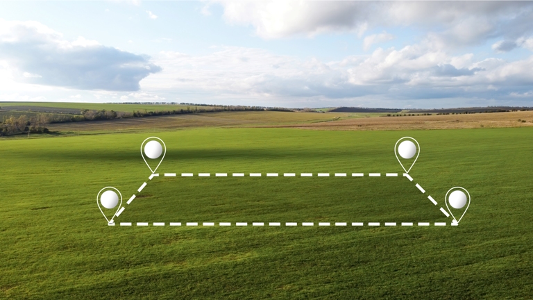
Agricultural maps have been critical assets for agricultural practitioners throughout history. Landowners and farmers know their farmlands like the back of their hands. With the introduction of digital maps, agribusinesses gain a competitive advantage by learning their land precisely based on data, not just experience. Agricultural field mapping is a vital necessity of precision farming.
Dynamic field mapping in the USA helps farmers find the exact locations of all crop varieties on their farms and navigate the area. They can also display location data on any crop variety. Apart from knowing the precise locations of different crops, growers and agribusinesses can get a ton of valuable data on soil, product origins, moisture, and nutrient levels.

Precision agriculture technologies:
Modern technologies like precision farming and farm mapping allow farmers to consider each field’s needs and characteristics. This means you can considerably reduce the use of fertilizers, pesticides, and seeds while increasing your crop yields simultaneously.
Technological innovations and geospatial technology help create a dynamic and competitive agriculture that protects the environment and provides excellent nutrition to the people. While natural inputs in agriculture cannot be controlled, they can also be better understood and managed with GIS applications. GIS can also substantially help in effective crop yield estimates, soil layer amendment analyses, erosion identification and remediation. More precise and reliable crop estimates help reduce uncertainty.
Agricultural mapping:
A central issue in agricultural development is the need to increase productivity, employment, and income of poor farming population segments; applying GIS in agriculture can address this situation. GIS tools and online web resources are supporting farmers to carry out crop forecasting and manage their agricultural production by utilizing multispectral imagery collected by the satellites. The capacity of GIS to analyze and visualize the agricultural environments and workflows has proven to be very helpful for those involved in the farming industry. GIS can analyze soil data and determine which crops should be planted and where and how to maintain soil nutrition to benefit the plants.
GIS in agriculture also helps farmers to achieve increased production and reduced the costs by enabling better management of the land resources. The risk of marginalization and vulnerability of the small and marginal farmers, who constitute almost 85% of farmers globally, also gets reduced. Agricultural Geographic Information Systems using Geomatics Technology enable farmers to map and project the current and future fluctuations in precipitation, temperature, crop output, etc.
Field mapping agriculture practices with GIS:
Farming may seem a million miles away from the land of modern tech and gadgets. However, the agricultural sector is increasingly considering the benefits of utilizing GIS. Our farmland is continually pushed to its limits to meet global demands, and taking advantage of tools that can help us increase output and reduce and better manage our inputs is necessary for our agricultural activities to be sustainable.
A GIS mapping software can be for anyone who needs it, whether you’re an owner of a small independent farm or a farm manager of a large operation. Understanding every aspect of your land and effectively mapping out resources is invaluable to maximizing productivity and ensuring the continued health of every plot of land. We have various features to help farmers get the most out of mapping software. Visually analyze your resources, retrieve soil reports, learn what kinds of activities types of soil can tolerate, view topography and contour lines, map out water features and floodplains, and build custom databases for anything from crop yields to irrigation pipelines.
Exploring GPS mapping tools and technologies:
GPS receivers and satellite systems form the backbone of GPS mapping technology by providing accurate positioning and navigation information. Other satellite systems like GLONASS and Galileo also contribute to global position accuracy. GPS receivers receive signals from satellites, allowing users to determine precise locations.
Dynamic field mapping in the USA is vital in GPS mapping and analysis. GIS software enables users to store, manage, analyze, and visualize spatial data. GIS allows farmers to combine GPS data with land boundaries, topography, and infrastructure to gain valuable insights. GIS facilitates informed decision-making, spatial planning, and resource management.
Remote sensing and aerial imagery technologies complement GPS mapping tools by providing detailed and up-to-date visual data. The combination of GPS data with aerial imagery of the Earth’s surface captured by drones or satellites enables accurate mapping and monitoring of landscapes, vegetation, and infrastructure. Remote sensing techniques like LiDAR (Light Detection and Ranging) provides 3D data to enhance the precision of mapping and analytical tasks.
If you want expert advice regarding agricultural soil mapping in your field, contact our experts at SoilOptix®!
