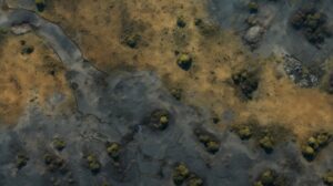
Soil is an essential component of the environment. For this reason, there is a need to study and research more about it. Remote sensing technology has taken the world by storm, presenting a new frontier in understanding our soil. With the ability to capture detailed images and data from space, this technology is revolutionizing how we view and manage land resources. The application of remote sensing in soil mapping can make this possible conveniently.
Understanding remote sensing in the context of soil mapping:
Remote Sensing (RS) data have emerged in the last few decades as promising secondary sources for improving digital soil mapping at all scales. Remotely sensed data sources:
- contain extractable information, e.g. spectral reflectance,
- have sizeable spatial coverage and, therefore, permit mapping of inaccessible areas,
- produce consistent and comprehensive data both in time and space, and
- offer possibilities for supplementing or reducing traditional soil sampling in soil surveys.
Based on these advantages, several studies have explored using RS data with varying spatial, temporal and spectral characteristics in digital soil mapping.
Remote sensing in agriculture:
Remote sensing and agriculture always go hand in hand. The basic functioning of this technology with UAVs, satellites, and other platforms is also almost the same. The sun’s energy travels from the sun to the Earth in the form of light waves. Light waves travel virtually like the ocean waves – the distance between one wave’s peak and the next’s height is known as wavelength. The energy emitted from the sun is called electromagnetic energy and is a part of the electromagnetic spectrum. The wavelengths used for agricultural applications cover a small amount of the electromagnetic spectrum.

Either of these three things can occur when electromagnetic energy strikes the plants during hyperspectral remote sensing in agriculture. The power will be reflected, absorbed, or transmitted, depending on the energy’s wavelength and the plant’s characteristics. Remote sensing technology can detect reflected, interested, and transmitted power.
The relationship between the three occurrences now determines the spectral signature of plants, which is unique to different plant species. Remote sensing in farming helps identify stressed areas by determining the spectral signatures of healthy plants.
Applications of remote sensing in agriculture:
Remote sensing technology has numerous applications in forestry, geology, surveying, and photography. However, remote sensing in agriculture has been found most helpful. Some of the diverse applications of agriculture and remote sensing include the following.
1. Observing and monitoring crops:
A crucial role of remote sensing in agriculture is analyzing the health of crops. Optical (VIR) sensing allows soil scientists to see beyond visible wavelengths, like infrared. In this case, the wavelengths are also very sensitive to crop vigor, damage, and stress. Recent technological advances have allowed farmers to observe their fields well and make timely decisions on crop management. Crop identification using remote sensing also helps to identify crops affected by conditions related to the weather, pests, etc.
2. Observing soil conditions:
For precision agriculture, monitoring of the soil layer is essential. Some crucial soil parameters to optimize crop management functions include soil organic matter (SOM), soil texture, pH level, moisture content, etc. Remote sensing technology in agriculture will also offer canopy health, growth stage, crop yield, biomass, and vegetative density. To investigate the changes in crop growth patterns, you must emphasize the link between crop performance and soil conditions.
3. Monitoring water conditions:
Due to population growth and food demand, irrigated lands are expected to double by 2050. It will minimize water availability, contribute to climate change, and cause the other environmental changes. Hence, the monitoring and assessing agricultural water resources are critical to sustainable food security and development. Remote sensing in precision farming has provided accurate and timely information like the water bodies, irrigated cropland, crop and water status in soil, and various scales.
4. Predicting weather conditions:
Climate and weather data systems are essential for crop management decisions and irrigation schedules. Additionally, this data can also help you prepare well against natural disasters. This application of remote sensing techniques in precision farming practices has provided the spatial coverage to predict future weather conditions successfully. With the help of this data, you will be provided with better predictions of crop needs and help to cut unwanted costs.
5. Observing air quality:
Different types of crops thrive well in different air conditions. Some may do well against the windy air conditions, while others are more suitable for calmer environments. Remote sensing in plant protection has allowed us to determine the air conditions in specific locations. This crucial data can help you predict upcoming air conditions so you can take the necessary precautions in case of unfavourable weather conditions.
